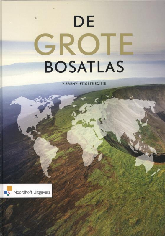
In geography, the atlas is the most used item in the coming years. In the atlas you can find a lot of information. For example: 'where is Oss located' or 'how many cows can we find in Noord-Brabant'? On this school (Maaslandcollege) we use the Grote Bosatlas. There are two editions we use: the 54st edition and the 55th edition. You never bring your atlas to school.
55e druk
54e druk
Type of maps (soorten kaarten)
The maps in The Grote Bosatlas can be divided into 3 different groups:
General maps. For example: North, Middle and South Netherlands.
Thematic maps. Maps about one topic (onderwerp)
Topographic maps. Maps with a small scale number. For example: street map
How can we find these maps in the atlas? What is the difference between these maps?
In this chapter we will take a look at all these type of maps seperately (apart/los van elkaar).
General map The Netherlands (Nederland)
General map:
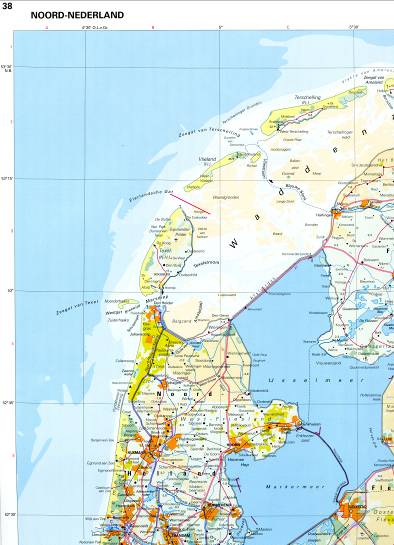
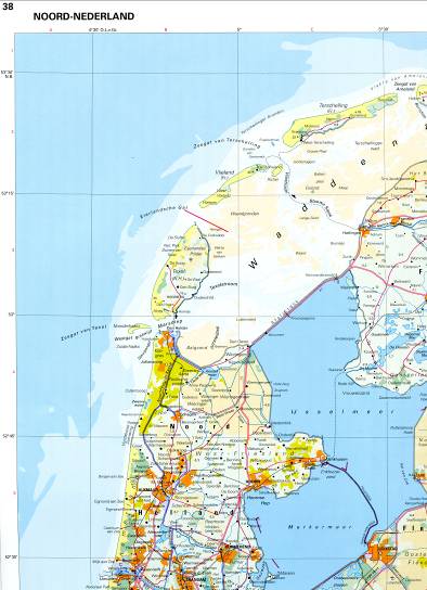
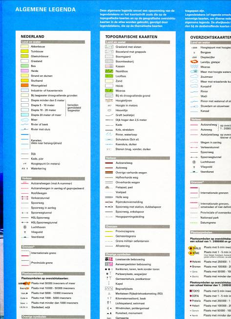
The map of the Netherlands is separated (gesplitst) into three parts. You can find these maps on page 24 to 29 for the 54th edition or page 20 to 25 for the 55th edition. The colours on the map tell you how the soil is used. So, if we ask you something about the land use (bodemgebruik) we will tell you to take a closer look at the general map of the Netherlands! What the colours of the map mean to us, you can find in the legend in the front of the atlas. See if you can find this!
Example of a general map of Noord-Nederland:
General maps
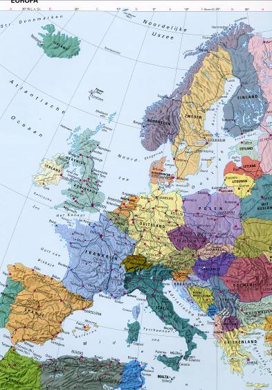
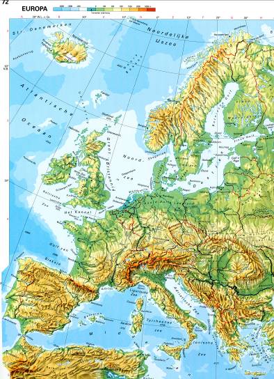
A general map gives you information about a certain area (gebied). For example a continent, a country or a part of a country or city. The information is usually (meestal) given in the form of lines and colour fields (kleurvakken). There are 2 types of general maps: natural- and political general maps. In the Grote Bosatlas you can find general maps about the World or Europe for example.
Political general map; every country (or province) has their own colour.
Natural general map; the colours on this map show you the height of the landscape. To give you a better orientation, the borders (grenzen) are coloured in. Some important cities are shown with a dot (stip). The legend (legenda) about the height is found in the form of a long, coloured beam (balk). This legend does not only show the height of the land, but also the depth (diepte) of the ocean or sea.
WATCH OUT: Below these 2 maps you will find the exercises.
Political, general map
Natural, general map
Thematic maps
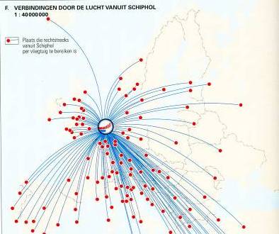
On thematic maps information is given about a special topic (thema). The information is usually given in the form of lines, color boxes, circles or icons (small drawings on the map). For example, in the Grote Bosatlas you can find theme cards about climate, population, tourism and the environment.
Topographic maps
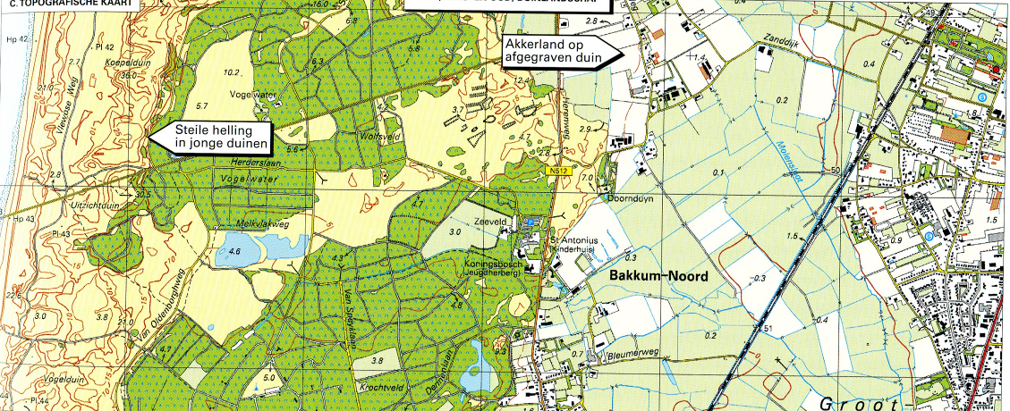
Topographic maps are large-scale maps that provide a very accurate picture of reality. You can observe many details on it. In the section Own Environment (map 34-37 54th edition) / 32-35 55th edition) you will find a number.
Municipal maps
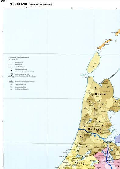
On municipal maps you can see how the Netherlands is divided into municipalities (gemeenten). Usually different places are part of one municipality. On page 260 to 263 (54th edition) / 286 to 289 (55th edition) in the atlas the municipal maps are shown.
What is on a map?
A map must contain the following components:
Legend Scale Title
Legend: The explanation of the colors, signs, lines and symbols can be found in the legend. Every type of map has its own legend. Often there is a map with the legend, but in the Grote Bosatlas there is also a general legend (algemene legenda) that applies to many maps in the atlas. You can find this in the front of the atlas.
Scale: On a map the reality has been reduced (verminderd/kleiner gemaakt) by the mapmaker. We then say: 'the maps are drawn (getekend) to scale'. Above the maps in the Grote Bosatlas you see the scale (schaal) and a scale bar (schaalstok).
Title: Each card must have a title that tells what the card is about.
Exercise 1
You will receive a assignment sheet (opdrachtenblad) from your teacher.
Draw your own street on the assignment sheet (if you live in a long street, take a smaller one).
When drawing, take into account (houd er rekening mee) what must be at least on your map and clearly indicate (laat duidelijk zien) what you mean by what you are drawing.
How to find things in the atlas?
There are many maps in the atlas, but how do you find the map that you want? For this you can use multiple (meerdere) tools: the table of contents (inhoudsopgave), bookmarks (bladwijzers) and the index (register). Once you have reached the right map, card slots (kaartvakken) can help you find a place. A card slot could be A5 or F1 for example. In this section all these topics are discussed.
Table of contents (inhoudsopgave)
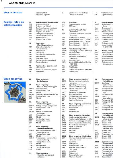
On pages 2 through 9 (54th edition and 55th edition) of the Grote Bosatlas, the table of contents contains the names of all maps from the atlas, with the card numbers in front. To search in the table of contents is not the most appropriate form (goede manier), but you do have a good overview of all the information you can find in the atlas. If you look at the table of contents, you see that the atlas is made up of a number of parts (verschillende onderdelen):
* Maps, photos and satellite images; examples and explanations about the many types of maps in the atlas.
* Own area; examples of how you can look at your own environment very accurately (precies/exact) using all kinds of maps.
* The Netherlands; after the political and natural overview maps you will find three large regional maps. On these maps you will find almost all places in the Netherlands. Because they are soil use (bodengebruik) maps, you can also see how the landscape looks with the help of these maps. After these maps, the thematic maps follow, which give you information about other subjects.
* Europe; first you see the natural and political overview map. This is followed by the thematic maps and the general (overzichts) maps of different countries and regions.
* The continents and the earth; for every continent you will find a number of thematic maps. The general maps of the entire earth follow after the continents.
* Statistics; in one place you can not see how many people live in a place, province or country. In the tables of the statistics you will find the correct numbers and data about many other topics. In the brugklas we almost never use this part of the Atlas.
Note: It is not the intention (bedoeling) that you search in the atlas through the table of contents. You must do the search through the registers at the back of your atlas.
Bookmarks (bladwijzers)
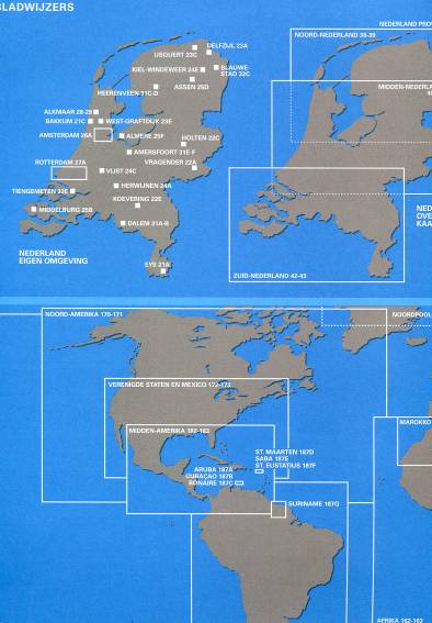
On the back cover sheet (at the very end of the atlas) are bookmarks included: the Netherlands, Europe and the continents on which frames have been drawn (waar hokjes omheen staan). Each frame refers to a map in the atlas. Name and number of the card are in the box. The bookmarks are especially useful if you are looking for a political overview map and if you know in which part of the world something lies!
Index of geographical terms (trefwoordenregister)
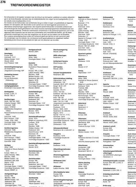
The index of geographical names (trefwoordenregister) contains (bestaat uit) references (verwijzingen) to maps on which you can find information about topics. The name and card number of each card is given. For example, you search for information about "earthquakes" in this index, you can see that information can be found on the following maps:
Earth on pages 188-189 / 170-171 and 192D and 174D
Japan on the cards 157B / D or 140B / D
Turkey on map 123A or 115A and 126D
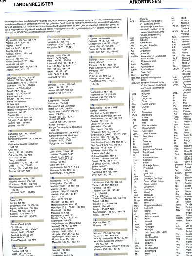
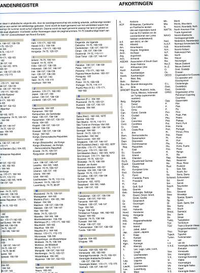
Index of countries (landenregister)
Have you ever heard of Samoa? Or from Tajikistan, Kiribati or Djibouti? If you see these country names in the newspaper or in class and want to look them up, you can use the index of countries in the atlas.
Index of topographical names (Register van topografische namen)
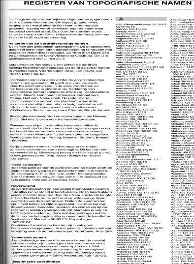
All place names, countries, provinces, mountains, rivers etc. are in the index of topografical names.
Here you can search by name in alphabetical order.
Abbrieviations (afkortingen)
If you see an abbreviation (afkorting) in the atlas that you do not know, you can look it up in the list of abbreviations.
Here you can find all abbreviations that are used in the atlas.
Card slots (kaartvakken)
To find places on the map, we use card slots or card boxes. There is a letter above and below the card and a number on the right and left of the card. There is a letter and a number in the registers behind a map. These refer to (verwijzen naar) the card boxes. This way you know which part of a map you have to look at.
If you have to tell on which map you have found something, you always have to mention the card slot behind the number.
How to read a map?
A map has a lot of information about an area. How do you get that information out of the map? You must learn to read a map!
For this you need to know the meaning of the colors, signs, lines and symbols on the map. A system of lines runs across most of the maps that divides the cards into boxes. What does that mean? How long is a cm on the map in reality? All these questions are addressed (komen naar voren) in this section.
Legend (legenda)
You will find the explanation (uitleg) of the colors, signs, lines and symbols in the legend. Every type of map has its own legend. An overview (overzicht) of map types and legends can be found on the front page of the atlas. The legend of thematic maps always show the legend on the map itself.
Always make sure that you use the correct (juiste) legend!
Scale
On a map, reality has been reduced by the card makers. We then say: 'the cards are drawn to scale'.
Above the maps in the Grote Bosatlas is the scale (schaal) and a scale bar (schaalstok).
For example, the map of the Netherlands contains 1:25,000 (pronounced: 1 in 25 thousand). This means: 1 cm on the map is actually 25000 cm. Of those centimeters you make kilometers: 25,000 cm = 0.25 km.
Tip: If you have to make centimeters of kilometers, you just get a handful of (five) zeros! Example: 1: 1200,000 means: 1 centimeter on the map is actually 1200,000 centimeters. From centimeter to kilometer you go in five steps: cm - dm - m - dam - hm - km. Every step goes a zero, five in total. You therefore reach 12 km.
Many (imaginary) lines have been drawn across the earth, making it possible to precisely (precies) indicate the position of a ship or a village. This is called the absolute location.
The equator is considered the center line of the earth. It is a line with some special characteristics (kenmerken):
* It is the longest circle that can be drawn around the earth.
* Day and night take the same time.
* The equator divides the earth into two equal parts (the northern hemisphere and the southern hemisphere.
* From the equator the North Pole is as far away as the South Pole.
Parallel to the equator are (on paper) lines drawn: the parallels. Each parallel has a number, which shows how far away the parallel is from the equator. At the equator the number is 00, the North Pole and the South Pole have the highest numbers: respectively 900 NL (northrn latitude) and 900 SL (southern latitude).
The distance between 2 parallels with a whole number (for example between 3000NB and 3100NB is about 111 km) is quite a lot and therefore each degree is subdivided (onderverdeeld) into 60 minutes (60`) and every minute in 60 seconds (60``).
Places that are close to the equator lie on a low latitude; places not far from the poles are at high latitude.
Circles of longitude (meridians)
With parallels we can divide (indelen) the earth into slices, but for a correct positioning, circles of lontitude are also required between the North Pole and the South Pole. These are the meridians. In 1884 the meridian of Greenwich (near London) was chosen as a zero line at an international conference. The prime meridian divides the world in the eastern hemisphere and the western hemisphere. The count starts at the prime meridian; on the other side of the earth these hemispheres meet at the meridian of 1800. Parallels and meridians together form the earth's degree network (gradennetwerk)
When we talk about the coordinates, it is important to know how to write them down. You must always first note the coordinate of the Northern- or Southern Latitude. Then you note the Longitude (western or eastern longitude).
Assignment 3
You now know a little how the coordinates work.
You can now make the assignments on the assignment sheet that you receive from your teacher.
If you have not received it you can also download it here.
Het arrangement Bosatlas Skills Maaslandcollege TTO is gemaakt met
Wikiwijs van
Kennisnet. Wikiwijs is hét onderwijsplatform waar je leermiddelen zoekt,
maakt en deelt.
Auteur
Lou Dieben
Je moet eerst inloggen om feedback aan de auteur te kunnen geven.
Laatst gewijzigd
2018-09-26 21:09:36
Licentie
Dit lesmateriaal is gepubliceerd onder de Creative Commons Naamsvermelding-GelijkDelen 4.0 Internationale licentie. Dit houdt in dat je onder de voorwaarde van naamsvermelding en publicatie onder dezelfde licentie vrij bent om:
het werk te delen - te kopiëren, te verspreiden en door te geven via elk medium of bestandsformaat
het werk te bewerken - te remixen, te veranderen en afgeleide werken te maken
voor alle doeleinden, inclusief commerciële doeleinden.
Leeromgevingen die gebruik maken van LTI kunnen Wikiwijs arrangementen en toetsen afspelen en resultaten
terugkoppelen. Hiervoor moet de leeromgeving wel bij Wikiwijs aangemeld zijn. Wil je gebruik maken van de LTI
koppeling? Meld je aan via info@wikiwijs.nl met het verzoek om een LTI
koppeling aan te gaan.
Maak je al gebruik van LTI? Gebruik dan de onderstaande Launch URL’s.
Arrangement
IMSCC package
Wil je de Launch URL’s niet los kopiëren, maar in één keer downloaden? Download dan de IMSCC package.
Wikiwijs lesmateriaal kan worden gebruikt in een externe leeromgeving. Er kunnen koppelingen worden gemaakt en
het lesmateriaal kan op verschillende manieren worden geëxporteerd. Meer informatie hierover kun je vinden op
onze Developers Wiki.